 I have almost completed the three pages dealing with geological features of Algoma. I plan to add a page or two every day while we are are at home in Midland.
This is Page 1 which deals with the general geology - the distribution of the major rock units in space and time.
Page 2 - "Road Logs" will include several self-guided geological tours along a few of the local highways and byways. These road logs are modified from those prepared for field trips for many of the university group and professional geologists who have visited Algoma to see evidence of the climate, atmospheric composition and tectonic history of the area.
Page 3 is tentatively titled "Other Geological Stuff" will include whatever I think you might find interesting.
Changes to these pages will be ongoing.
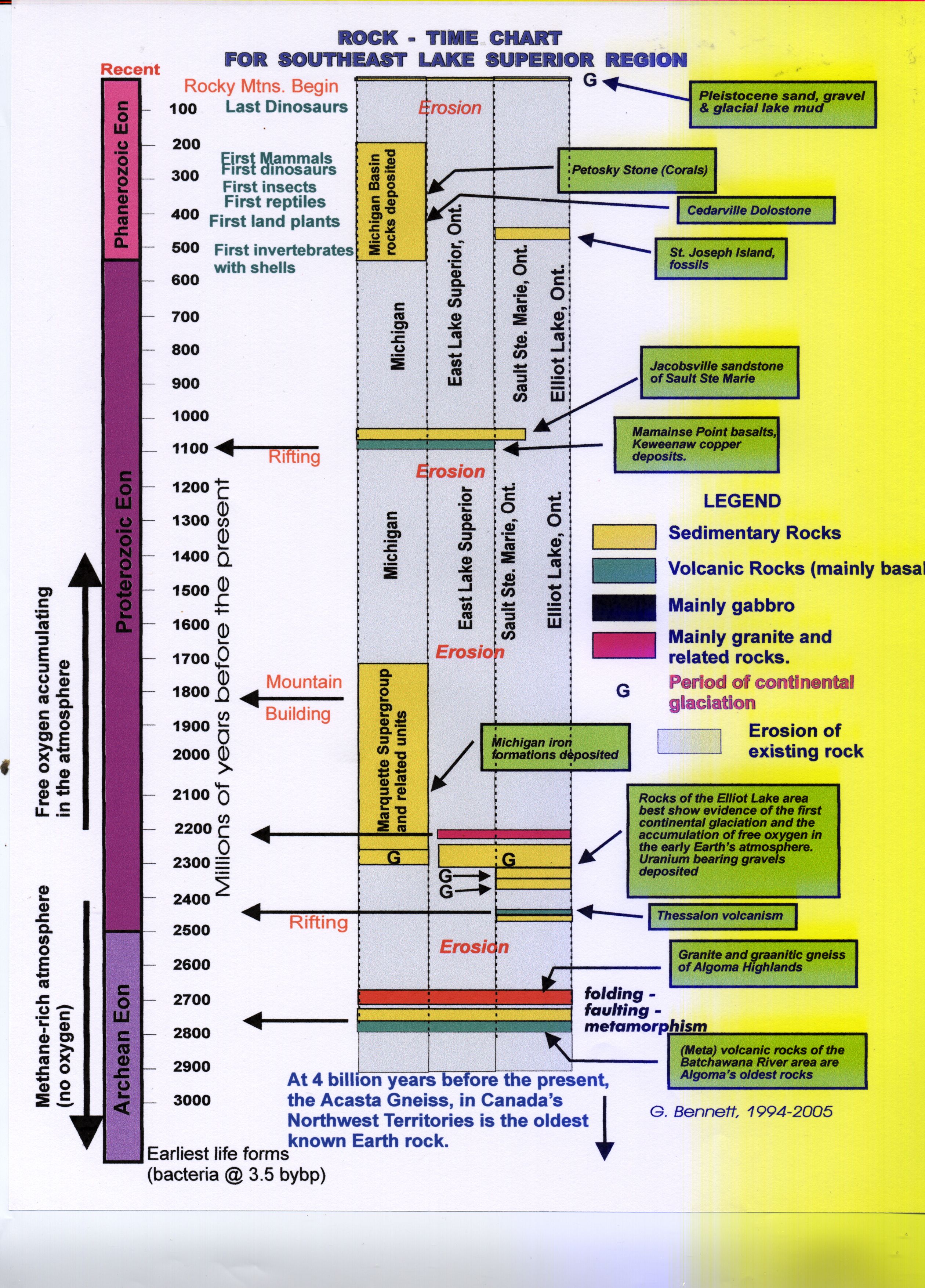
1a. A Rock-Chart for the Rocks of the Elliot Lake Area and the Southeast Lake Superior Region.
A carefull examination of the figure below will reveal a great deal of information about the age distribution of the geology of the Algoma District as well as part of Michigan (I hope).
You will see that the rocks presently present represent only a fraction of the last three billion years. During most of that period the rocks of what is now Algoma were above sea level and therefore exposed to the processes of chemical and mechanical weathering (erosion by wind, water and ice). The vertical number scale is in millions of years before the present (Mybp). The horizontal arrows point to absolute ages as determined by radiometric dating of the uranium and lead content of minerals. Note also the rise of atmospheric oxygen about 240 million years before the present.
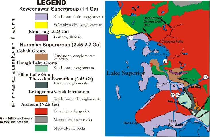
A geological Map of the South East Shore of Lake Supeior
The Map below is a bedrock geological map of the major rock types along part of the East Shore of Lake Superior.
The map is map is much a generalization of the rocks you will find in that area. For example: Do not expect to find only granitic rocks or gneiss (prnounced "gneiss") in the red area. Minor areas of older volcanic rocks and younger dike rocks and many other minor rock types are alo present. A much more specific detailed geological map is more representative. Page 2 will include more detailed road logs
which will illustrate the more site specific feartures of the geology along local highways.
A Geological Map of the Eastt Shore of Lake Superior 